Hiking near Benidorm: Serra Gelada and the mountains behind
Facts checked 15 October 2026 against the sources at the foot of this page.
Short answer
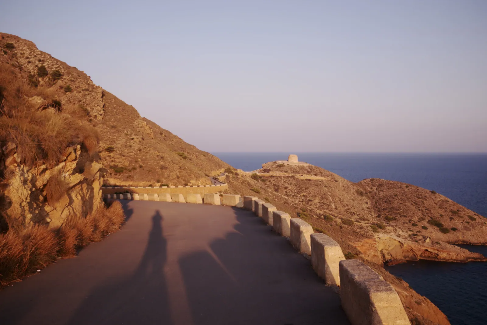
The best walk from Benidorm starts at the end of Levante beach. Serra Gelada, the natural park on the headland, has four marked routes. Two are easy: the paved lighthouse path from l'Albir (5 km return, 1.5–2 hours) and the climb to the Cross above Rincón de Loix (5 km return, about 3 hours, 237 m). The full ridge traverse is the big one: 8 km one way, 4–4.5 hours, with steep ups and downs and no water. Inland, Puig Campana (1,406 m) and Ponoig (1,181 m) are serious mountain days. Walk October to May. In summer, start at dawn and check for fire closures.
Key facts
| Fact | Detail |
|---|---|
| Serra Gelada park | About 5,600 ha of land and sea, cliffs up to about 300 m |
| Highest point of the ridge | 438 m |
| Easiest route | Faro de l'Albir: 5 km return, 112 m, paved, wheelchair-usable |
| Classic short climb | La Cruz from Rincón de Loix: 5 km return, 3 h, 237 m |
| Full traverse | 8 km one way, 4–4.5 h, moderate–hard, no fountains |
| Big mountain | Puig Campana, 1,406 m, from Font del Molí in Finestrat |
| Water on route | None on Serra Gelada; take at least 1.5–2 litres each |
| Best season | October–May |
| Fire ban days | Level 3 pre-emergency closes paths, e.g. 19–21 Aug 2026 |
| Emergency | 112 |
Serra Gelada routes at a glance
Figures from the Benidorm council's route guide (2005 edition; paths unchanged, but signage may differ).
| Route | Start | Distance | Time | Highest / climb | Surface | Difficulty |
|---|---|---|---|---|---|---|
| Blue: Tío Ximo and Punta de l'Escaleta | End of Levante beach | 5.2 km return (+700 m to Cala Tío Ximo) | 2–2.5 h | 75 m | Paved | Easy; wheelchairs |
| Green: La Cruz | Rincón de Loix tourist info point (C/ Gerona / Av. Derramador) | 5 km return | 3 h | 237 m | Road then path | Easy, steep in parts |
| Yellow: the traverse | L'Albir recreation area → Cruz → Rincón de Loix | 8 km one way | 4–4.5 h | 438 m | Rocky path | Moderate–hard |
| Red: Faro de l'Albir | L'Albir car park | 5 km return | 1.5–2 h | 112 m | Paved | Easy; wheelchairs, bikes |
La Cruz is the one most visitors do. It's marked with white and yellow signs from the Rincón de Loix tourist info point. Walk up Calle Berlín (the end of Avenida del Mediterráneo) or Calle Hamburgo, then follow the road up past the apartments until it becomes a path to the cross. The view over both beaches and the island is the best in town, and it's lovely at sunset — take a torch for the way down.
The traverse links l'Albir and Benidorm along the cliff tops. It zigzags hard at the start, with constant ups and downs, and there are sheer drops close to the path — not one for vertigo. There's no shade worth mentioning and no fountain. Most people start at l'Albir so they finish in Benidorm with the view ahead of them, then walk down from the Cross to Rincón de Loix.
Puig Campana (1,406 m)
The mountain with the notch in its summit, which you can see from most Benidorm balconies, rises behind Finestrat. The usual route starts at Font del Molí, above Finestrat village, and climbs a steep scree gully to the summit ridge. Trail apps put the circular route at about 10.6 km with roughly 1,000 m of ascent; allow 4.5–6 hours. The scree near the top is loose and hard on knees coming down. It's a real mountain: proper boots, 2+ litres of water, and don't start after 9am in warm months. If you just want a taste, the lower path around the base from Font del Molí is shady in places and much easier. See our Finestrat guide.
Ponoig and Sella
Ponoig (1,181 m), the "sleeping lion" above Polop, is a circular route from the village of about 13–14 km with 880–1,000 m of climbing, roughly 4–5 hours. It's less busy than Puig Campana and has excellent views of the coast, Bernia and the Puig itself. See Polop. Sella is a quiet village at the foot of the Aitana range, 30 minutes' drive inland. Popular walks include the Barranc de l'Arc circular (about 15 km, around 570 m of ascent) and the climb to El Divino (1,149 m) from the Sella refuge, about 690 m of ascent. Sella is also a big rock-climbing centre. See Sella.
Heat and fire: when not to go
Summer is the wrong season for these hills. From June to September, temperatures on exposed slopes can be far higher than on the beach, and there's almost no shade on Serra Gelada. Check AEMET's weather warnings (avisos) the night before. Fire risk matters more. When the Generalitat Valenciana declares level 3 pre-emergency (extreme risk), walking on paths and cross-country is banned in forest land across the region, and forest tracks inside named natural parks — Serra Gelada, Montgó, Penyal d'Ifac and others — are closed to cars, bikes and walkers. That happened on 19–21 August 2026. Lighting any fire within 500 m of forest land is banned at that level. Check the Generalitat's fire-prevention page or the local police social media before you set off.
Watch out for
- No water on Serra Gelada: carry at least 1.5–2 litres each, more in warm weather.
- Level 3 fire alerts close paths outright; you can be fined for ignoring them.
- Cliffs on the traverse are unfenced; keep children close and stay back from edges.
- Puig Campana's scree gully is loose and steep; poles help coming down.
- Starting late is the most common mistake: in summer, be off the hill by 11am.
- In an emergency call 112 and give your route name and nearest landmark.
Questions people ask
How long does it take to walk up to the Cross in Benidorm?
About 3 hours for the 5 km return from the Rincón de Loix tourist info point, including time at the top. It climbs 237 m, partly on a steep road. Go early or at sunset, and take water.
How long is the Serra Gelada walk from Albir to Benidorm?
8 km one way, 4–4.5 hours, reaching a high point of 438 m. It's rated moderate–hard because of steep climbs and descents, with no water and little shade on the way.
Is the walk to Albir lighthouse easy?
Yes. It's a paved 5 km return from the car park at l'Albir, about 1.5–2 hours with 112 m of climbing. The council lists it as suitable for wheelchairs and bikes.
Can you climb Puig Campana from Benidorm?
Yes, from Font del Molí above Finestrat, about 15 minutes' drive. Expect roughly 10.6 km and 1,000 m of ascent, 4.5–6 hours. It's a demanding mountain walk; start early and take plenty of water.
Are hiking trails closed in summer near Benidorm?
Sometimes. On level 3 fire-risk days the Generalitat bans walking on paths and closes tracks in natural parks, including Serra Gelada. This happened on 19–21 August 2026. Check before you go.
When is the best time to hike near Benidorm?
October to May. Winter days are often 15–18°C and clear. From June to September only go at dawn, and only on short routes.
Book it: trips and tickets
GetYourGuide widget. We earn a commission if you book, at no extra cost to you.
Hotels near Hiking near Benidorm with live prices
Live prices from Booking.com, Expedia and others via Stay22. We earn a commission if you book, at no extra cost to you. How we earn.
Sources
- Ajuntament de Benidorm / Línea Verde — Rutas Sierra Helada (PDF) — four routes: distance, time, max height, surface, difficulty — checked 2026-10-15
- Visit Benidorm — Hiking in Serra Gelada — 5,600 ha, cliffs up to 300 m, 8 km / ~4 h traverse — checked 2026-10-15
- GVA Parques Naturales — Serra Gelada yellow route — max height 438 m, moderate–high, start at l'Albir lighthouse road car park (search excerpt; page did not load) — checked 2026-10-15
- LinkAlicante — Travesía de Serra Gelada (updated 30 Mar 2026) — 8.5–8.7 km, 4.5 h, cliffs, little shade, bus 10 — checked 2026-10-15
- AllTrails — Puig Campana — 6.6 mi, 3,333 ft gain — checked 2026-10-15
- TrailExplorer — Puig Campana — summit 1,406 m from Finestrat — checked 2026-10-15
- Wikiloc — Ponoig (1181 m) from Polop — 14.24 km, 999 m — checked 2026-10-15
- Nordic Walking Alicante — Ponoig — 13 km, 880 m — checked 2026-10-15
- Wikiloc — Barranc del Arc, Sella — 14.93 km, 571 m — checked 2026-10-15
- Las Rutas de Moskys — Divino from Sella — summit 1,149 m, 692 m ascent — checked 2026-10-15
- Ayuntamiento de Alicante — Riesgo extremo incendios (Aug 2026) — level 3 bans, Serra Gelada tracks closed, 19–21 Aug 2026 — checked 2026-10-15
- AEMET — Avisos — official heat warnings — checked 2026-10-15